Tintagel to Port Isaac
- Aug 12, 2025
- 4 min read

From the Itinerary: August 10, 2025. Rated Challenging - Severe. The relatively easy walk out of Tintagel allows you to enjoy some of the spectacular views from this section of the North Cornwall coast before commencing a particularly challenging walk to Port Isaac. The path between Trebarwith Strand and Port Isaac is especially long and difficult, with some steep descents into valleys and tough climbs up to the cliff tops again, especially beyond Bounds Cliff.
Historically this area was significant for fishing and fish processing as well as slate extraction and there are remnants of these trades to be seen on the Coast Path. This stretch is designated both Heritage Coast status and an Area of Outstanding Natural Beauty so it is worth persevering along the harder stretches.
Port Isaac is a real reward at the end of this strenuous walk, with its beautiful alleyways, many listed buildings and harbourside cafes and pubs. You may well recognise Port Isaac from the TV series Doc Martin, as it is the village he lives in (renamed as Portwenn in the series).
Distance: 9.56 miles. Weather: 70s with just some drops of rain in the afternoon.


Tintagel Church of St Materiana’s with its Norman font and windows and a Roman milestone situated in the south transept.
Quite an impressive church from the outside and it's visible for miles along the coast. Didn't go inside


Standing on Glebe Cliff: thought to be the site of a royal cemetery which served the dynasty of Tintagel headland.
Stood on top of the cliff, which was all rocks, and not sure where the cemetery would be. Here are some shots


Stunning Trebarwith Sands.
I didn't think this was so stunning and had to walk down to it and up steeply after it. The sun was out and it was baking. Lots of overly white Brits


Climbing from sea level to the top of Dennis Point (300ft, 90m), taking in the views and preparing to climb back down to sea level again on the other side!
Not as awful a climb as the one I posted a few days before - maybe I'm getting used to it?


The remains of slate quarry buildings and donkey tracks around Backway’s Cove, now a haven for butterflies and coastal flowers.
Interesting to see the buildings - not sure I saw the donkey tracks. Some very big caves at the base of the cliffs.


Birdwatching on Bounds Cliff (420ft). This is a good place to spot peregrines and nesting guillemots and kittewakes in the summer.
Didn't see anything but seagulls, but I could smell the rookeries.
The cob walled fishing cellars of Port Gaverne, which once handled 1.5 million fish a week.
Saw Port Gaverne from the start of today's hike and was hoping it was Port Isaac. Nope, there was one more steep hill to climb into the last stop of the day....
Exploring the beautiful fishing village of Port Isaac, with its network of alleyways, including one especially narrow one called ‘Squeeze-ee-belly’. This unspoilt village has frequently been used as a TV and film set and can be seen in Doc Martin, Poldark and Saving Grace.
As a big Doc Martin fan, I've always loved Port Isaac and we were here before Covid. The town hasn't changed (and probably hasn't for 200+ years). Lovely place, but too many tourists.
Breakfast was the usual egg/sausage/yogurt and I wolfed it down to get a headstart, since I needed to be in Port Isaac by 4 for afternoon tea.


I started the day feeling sun burned and very sore, even though I warmed up before walking. The sun was very hot until about 11am when the cloud cover came in. There were some spatters of rain, but that's it, so it made for pretty nice walking conditions, but I still felt hot because there wasn't a breeze.
A few shots back towards Tintagel. King Arthur alone on his castle site. An interesting rock stack. leaving town and seeing the castle ruins from another angle.


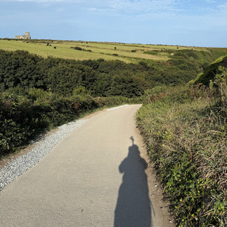


I could see Port Isaac all day, from leaving Tintagel - it never got closer.


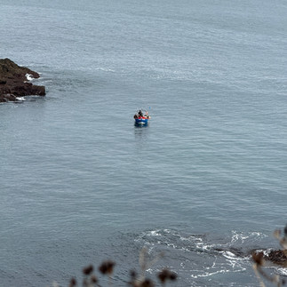
It was very undulating with some very slick downhill bits. Here are some shots along the way


Some interesting erosion


Here's a better example of the cliff degeneration - I've circled it so you can see the depression before it falls


I'm almost to Port Isaac and I can still see the Church of St Materiana’s in Tintagel


That said, it wasn't as bad as I expected and I made it to Port Isaac at about 2:30, so well in time for my champagne tea that I was worried about missing.


For those who like Doc Martin: Here are some photos of the school and Doc Martin's house and the waterfront.


Here's my hotel - The Slipway


I decided to upgrade my creme tea to include a glass of champagne. Not sure it was worth £23 for 1 glass and 2 scones.


Dinner was peppers and a garden burger - pretty good (or I was pretty hungry)


Consistently the distance has been off. My guidebook said 9.1 miles, my app said 8.7, but, at the end of. the day, it was over 10 miles.


very nice - and glad that Buni got somethig to eat he could at least recognise.