Taupo
- May 23
- 10 min read
May 13 - 20, 2026 we stayed in an AirBnB at Taupo (pronounced Toepaw), North Island in New Zealand. Taupō, population ~44,000, is home to Lake Taupo, New Zealand’s largest lake (and the larges lake in Asia), a 622-sq-km body of water filling the caldera of an active super volcano. The lake is the size of Singapore. Depending on which website you read, the super volcano here is the second largest in the world - second only to the one in Yellowstone. The region is renowned for trout fishing, geothermal activity like Craters of the Moon, and the powerful Huka Falls . The town, named after a Māori explorer's cloak. We looked forward to hiking and soaking over this week.

May 13 - Drive from Wellington to Taupo. This was about a 5+ hour drive half way up the North Island. We had several stops along the way. Weather was again lovely (for the entire week of our stay).


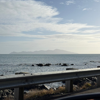
We took the more coastal route along the Kapiti Coast where there were views of Kapiti Island.

There was a stop in Foxton which was a dutch settled area with a wind mill used to grind flour.


The area is known for Foxton Fizz which appeared to be a fizzy soda drink. Since neither of us care for this sort of thing we didn't try it.

There was a quick fun stop at Bulls where we saw all the "bull" pun signs.


Next was Taihape where we stopped for lunch at the Brown Sugar Cafe.


Taihape is known as the "gumboot capital" because they have gumboot throwing competitions and a sculpture of a large gumboot as you leave town.


Probably the most interesting stop in the museum category during our entire trip so far was the National Army Museum in Waiouro. We saw a detailed history of New Zealand's war campaigns, from Maori times to present.


The final part of the journey was through high volcano country where we saw evidence of continuing volcanic activity and the high desert.


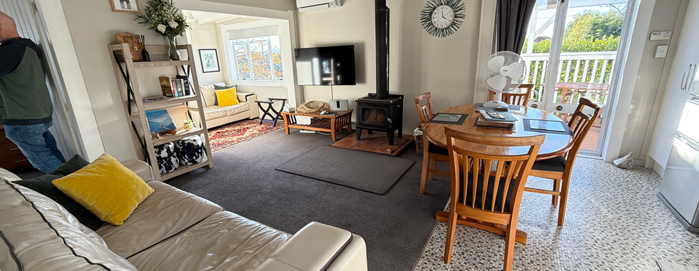
Before finally arriving at Lake Taupo and our AirBnB for the week - Calida's Cosy Cottage.


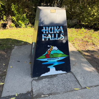
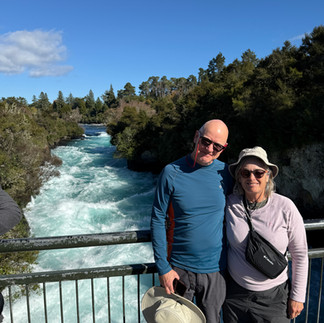
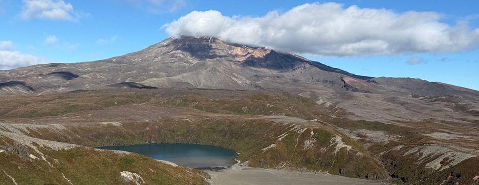
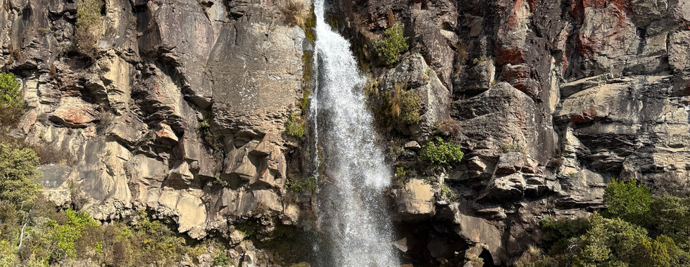
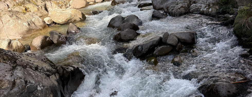
May 14 - Huka Falls Loop and Tuahara Track. Today we made a quick trip over to the local Huka Falls and a short mile walk around the area. According to AI, Huka Falls is New Zealand's most visited natural attraction. It features a massive volume of water - up to 270,000 liters/second - rushing through a narrow 15-meter wide volcanic canyon and falling 11 meters, creating a distinct bright turquoise foam and thunderous roar.


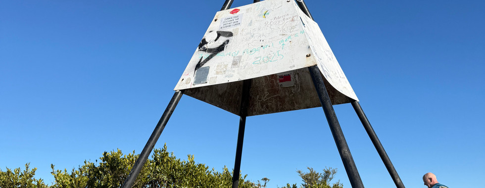
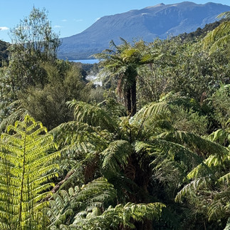
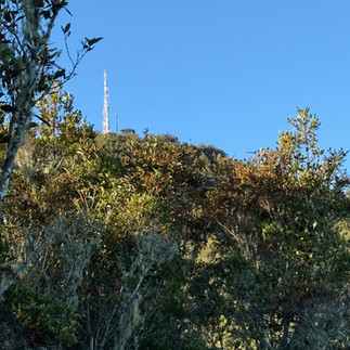
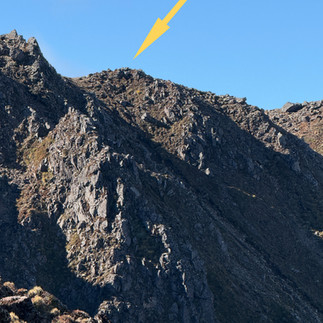
We continued the day with a steep hike up the Tuahara Track. While only 5 miles, we climbed up 1100 feet in about 2 miles. On our last day we saw where we actually climbed. The arrow points to the highest point of the hike.


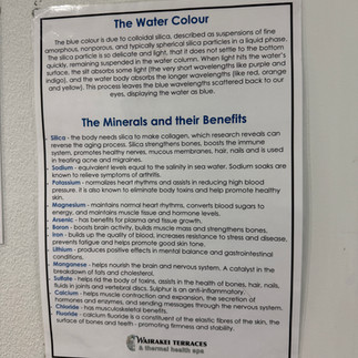
May 15 - Waimangu Volcanic Valley and Rainbow Mountain and Crater Lake Outlook Track. Wairakei Terraces Thermal Hot Pools.
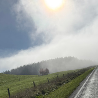
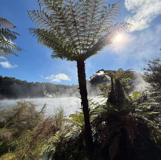
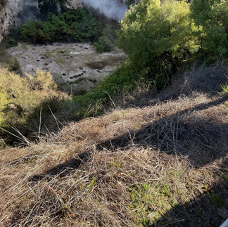
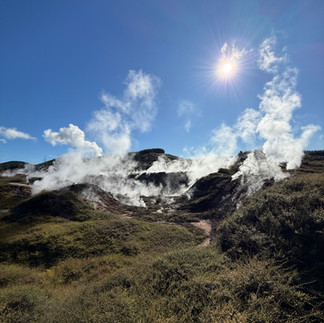
Today was a busy day. We started at the Waimangu Volcanic Valley which was an hour + drive through the volcanic, thermal valley. We drove through areas of thermal activity blowing steam and creating ground fog.

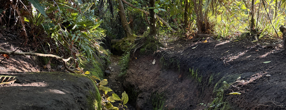
The Waimangu Valley itself was a 4 mile hike through a geothermal system created during the 1886 volcanic eruption.


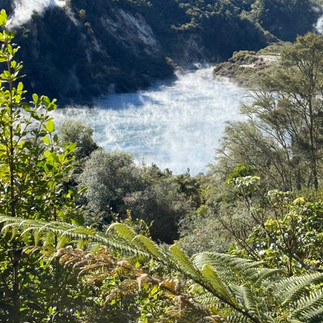
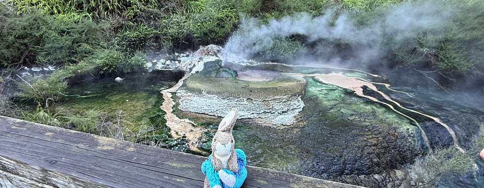
From there we walked downhill by steaming lakes (Frying Pan Lake is pictured below)


with boiling fumaroles
and steaming streams


that finally cooled enough that the swamp hens could walk through them


and finally into the large Rotomahana Lake and you can see the crater that resulted from that original eruption.


This eruption destroyed the pink and white terraces which were referred to as the "eighth wonder of the world" - we did see what was left over which wasn't very interesting. We took the bus back to the visitor's station at the park entry.


Now it was time for another steep hike up Rainbow Mountain and Crater Lake Outlook Track. This was another steep, but short hike. This time we made 1100 feet of elevation over 1 mile. The entire hike was 4 miles. This was from half way up the hill and the top looked impossibly far away.

The crater lake was uninteresting and it looks like the word "rainbow" applies to the red/white cliffs and red clay along the way.


The way up was very pretty, through forest most of the way.
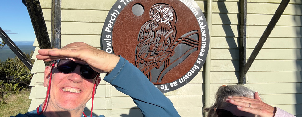
At the top there was some history. This is where the Maori retreated during times of war. They had a magnificent view of the valley from here. We aren't saluting, but the sun was right in our eyes.


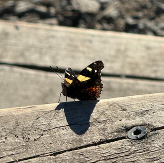
a moth posed for us


I was able to get some pretty good shots of my new favorite bird - fantail. They flit around like butterflies. These shots were from rather far away. Before zoom

after zoom


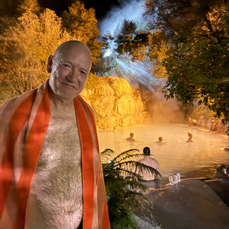
This evening we decided to try the thermal pools nearby (adults only). This hit the spot and even Chris enjoyed himself. Note to self - don't put hair in because it feels like straw when it dries....


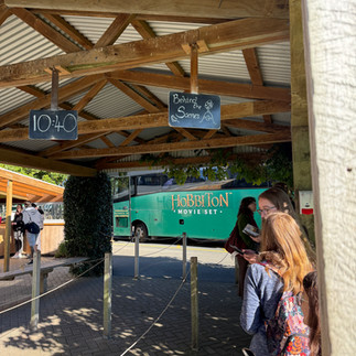
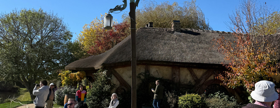
May 16 - Hobbiton Movie Set (and Tourist Farm?)


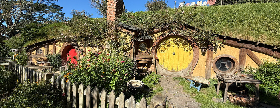
I am not a big Lord of the Rings fan, but was curious. We watched all the movies again to refresh the concept over the last few weeks in order to keep a lookout of all the possible movie set sights. Today was a rather long drive (1 hour+) to Matamata and the Hobbiton Movie set. As you may recall, this set is over 4.1 hectares of a lucky farmer's fields and was torn down after movie 1. Then it was rebuilt (after some negotiation - see below) as a permanent set for the subsequent movies.
After movie 1, fans started to trickle in to see the area and this became a bit of a side business for the farmer's family (encouraged by the son). When sequels were in the offing and the producers approached the farmer to use the site again, he agreed with the understanding it would be permanent and he could continue/expand the tour business. We actually saw the son during our tour (no photo), when he almost ran us down in his golf cart while giving a VIP tour to some other people.
ANYWAY. There was one lady from So-Cal on our tour who was "in the business" and she delighted in telling Chris (and several others) that there is another prequal in the works - I hope that's not supposed to be a secret, but I'm sure the farmer is happy.
Yes, there were people who dressed up to take the tour. NO, we didn't. We had to take a bus from the entry to the "set".


I have to say the set was bigger and prettier than I was expecting and I enjoyed my day. The "set" was more like a multi-acre park.


For some reason a bi-plane was buzzing around.


Here are some hobbit houses you might recognize from the movies


The inside of these houses are empty (used for storage) because any shots involving the inside of the hobbit holes were filmed on a sound stage. They did have to do some of the entrances for scenes where actors were entering the houses.

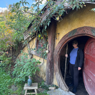


They finally did develop the inside of 2 of the hobbit holes so visitors could experience this and get a feel for the scale.


Lunch was included at the Mill - hobbit banquet style. I have to say it was probably one of the better meals I've had eating out in New Zealand. It included chicken, lamb, cottage pie (mince), salads, potatoes.


We had ale and cinder in the Green Dragon Inn before lunch - also quite tasty. Our "local" in Liphook is also the Green Dragon, but much smaller than this one.


Here's a shot of the bridge that has also been in the movies featuring The Shire.


After lunch we had some cheese and champagne on the hill overlooking the movie set. On the right is Chris setting up for his "influencer" shot.


On the way back we went through a town that had buildings made to look like animals.


We motored back while the sun set.


May 17 - Sunday market and a day off.
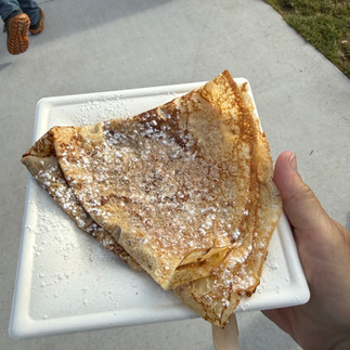
This morning we went to the local craft market. Of course I had to try all the sweet things which included a really great cinnamon bun (#2 after Bluff)


and a mediocre cinnamon/sugar crepe.

We also bought a small sweet/salty locally fresh made popcorn which is almost gone as of this typing. Think of salty, buttery, cracker jack.


May 18 - Mt Tama Lakes, Taranaki Falls, Tawhai Falls
A long day of great hiking today. The only down-side was the hour+ drive to get to Tongariro National Park. Thankfully the weather was dry, cold and only a bit windy. I think this is one of my most interesting All Trails trail snapshot - you can easily see how we were walking between the volcanos.

Originally we wanted to do the Tongariro Alpine Crossing. This is one of the "most popular day hikes in the world" and goes through a sensitive, avalanche, high dessert area and the hiker sees the Blue Lake, Red Crater, and Soda Springs as you go by several volcanos. While the weather was great and it was probably a missed opportunity, we decided not to take a chance with needing winter gear (think ice pick, crampons, beacon locator, etc) and arranging one way transport (it's an out only track).
Everyone recommends the Upper Tama Lake track as a great alternative without the crowds. It was about the same length (11.25 miles) and not quite as much elevation gain (2320 vs about 2500). For some reason all of the elevation gain in NZ hiking seems to come in about one half mile and this was no exception. This elevation came with scree to make it a bit more interesting. It's also nice because the hike is out and back with a nice alternative return via Taranaki Falls.
It was quite odd to see Chateau Tongariro near the trail head. It was completed in 1929 as a hotel and resort complex modelled after the hotel at Lake Louise in Canada. Turns out this building was effectively abandoned after it did not pass its seismic reviews. Although a category 1 historic place, the cost of refurbishing it was too much for the owners and it is now closed permanently (or until such time that NZ decides to pay for the repairs).


The Upper Tama Lake track was relatively easy until the last bit. The track was well maintained and undulating all the way to the Lower Tama Lake. There were several river crossings and I was very glad that the water was low as some of them would have been a bit of a challenge to cross.
There was an active possum along the trail - we didn't see the possum, but did see his droppings along the way.


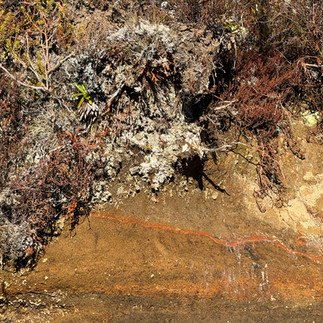
It was interesting and easy to see the soil/ash layers along the trail.

In the morning there were several areas with ice and we were lower than on the Alpine Crossing (mentioned above). I suppose the Alpine would have been worse, so was rather glad we chose this option.


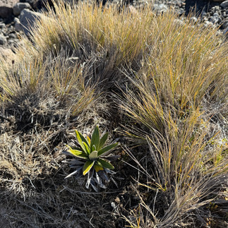
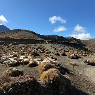
There was also some interesting flora which included high altitude mosses, lichen and plants.


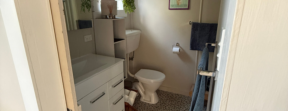
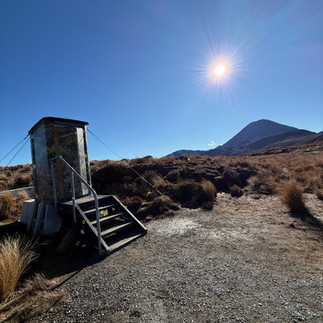
There were also some very pretty "loos with views".

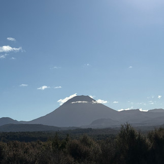
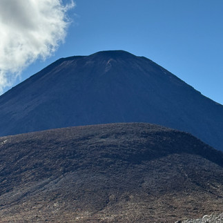
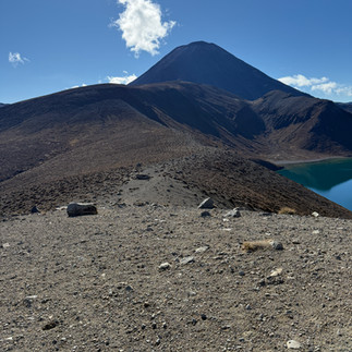
The weather was wonderful and all the volcanos in the area were visible. Mount Doom (The Lord of the Rings (TLOTR)) was visible and we got quite close by the time we got up to the Upper Tama Lake.


The Lower Tama Lake was low and not a lot to see.


From there the trail to Upper Tama Lake wasn't maintained


and was quite steep and there was a lot of scree. The first shot on the left is looking up to the summit as we were coming down. At the time you could see people, but it's hard to make them out in this photo.

It wasn't very difficult or technical and was a nice change. The views were amazing. One of the best things was that we only saw 1 person along the way and we had the place to ourselves at the final lookout

where we stopped for lunch.


It was clear the wind must be quite strong at times because someone built a "fort" or wind block a bit lower around the lake.


People started to show up after about 15 minutes and we started back.
Our return was via Taranaki Falls which was one of the prettiest waterfalls we've seen to date and a very nice return path.


Close by we walked to see Tawhai Falls which was the filming location for the Gollum's forbidden pool in TLOTR: The Two Towers. Something we had to see since we were in the area, but not as nice as Taranaki Falls.


May 19 - Craters of the Moon and a sailing trip on Lake Taupo
Craters of the moon is something I saw a lot of in social media and local "what to do" sights. Give it a miss. Thankfully it was very cheap. At least it was a nice 30 minute way to stretch our legs.
Craters is "one of New Zealand's most fascinating geothermal short walks". Basically, it was watching steam come up from the earth. The one possibly interesting boiling mud pool didn't have mud, nor was it boiling.


Anyway, there were some nice photos of steam.


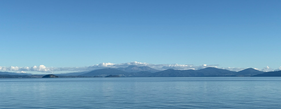
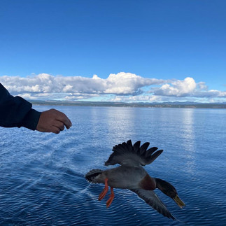
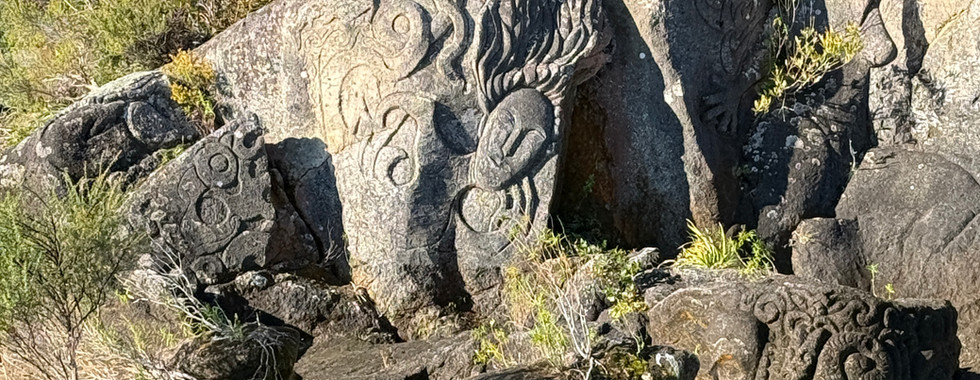
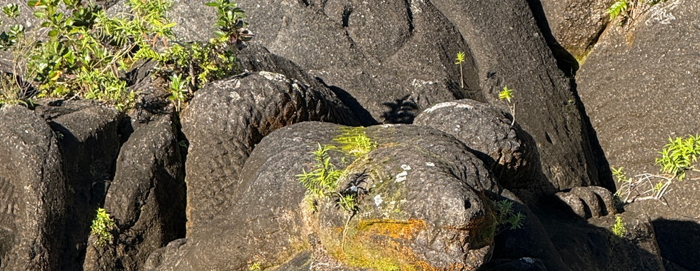
Following this, we were booked on a (motorized) sailing trip on Lake Taupo to see Maori rock carvings. The skipper was the partner (aka husband) of the owner of our AirBnB. Thankfully the boat was motorized because there was zero wind, so, unfortunately, we were on the motor the entire way.


He (and all the other boat skippers) had a trick of feeding the ducks along the way. I'm surprised these ducks could still fly, given they are fed ginger cookies at least twice a day.


On the way back, the skipper pointed out "the pregnant lady" who was resting. It turns out the first day we hiked up to her breast. (see above)/


The maori drawings turned out to be rock carvings done over several years, starting in1976. We were both under the impression that they were ancient rock carvings before going, so this was a bit disappointing. That said, the carvings were very pretty.


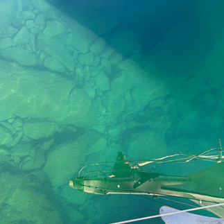
The water was incredibly clear.

Tonight we went out for dinner since we used up most of our food. We went to Vine on a recommendation and this turned out to be disparately average and very expensive. I had french onion soup and venison tartare. Chris had pasta.


From here we have a long drive to New Plymouth where we plan to stay another week. More news from there.


Comments