3776
- Aug 24, 2023
- 7 min read
From the itinerary: Day 6 | Hike up the sacred Mt. Fuji (20.08.2023)
Today, you will begin the actual climb of Mount Fuji. You will spend the night at Taishikan
Mountain Hut, where you will also have dinner upon arrival. You will also be offered breakfast
for the following day – this will be served as a bento, when you start your final climb up to the
top the next day.
Make sure to check the official website for climbing Mt. Fuji for all the information you need.
The Yoshida Trail is normally used by first time climbers, so we recommend this one as well.
Taishikan Mountain Hut
• 1x small room (with breakfast and dinner)
• Please show this when checking in.
• Check-in: on 20:08
• Check-out: on 21.08
• Address: 7 Chome-15-8 Kamiyoshida, Fujiyoshida, Yamanashi 403-0005
• 8th Station, Website
• Telephone: 05-5522-1947
One of the big days of my trip has finally arrived and I ascended Mount Fuji- by myself, no guide. I have been dreaming of this day since September 13, 2015 when I came out to the 5th station just to have a look and started up the trail, even thought the official climbing season ended about a week earlier. On that day the weather was sunny and cold - visibility was great, but you could certainly see snow on the mountain.


I still do not know how far up I got that day - I guess at least to one of the tea houses (which of course was shut). Since there was no moraine , I'm guessing maybe to the first hut on the 7th station.


But back to today, I had no sleep but was glad to be at the trailhead so I could start at dawn. My strategy was to start early, both to avoid the crowds and the rain. Weather reports had possible thunderstorms all day, not just in the morning, but my experience in the mountains has the rain coming in the afternoon, around 3:30, like happened yesterday.
Here is my route:

The dot at the top left corner is the 5 th station and where I started in the morning. The yellow dot is the 6th station and first aid station. When I took the screenshot I must have been around the 7th station. My hut was at the arrow and the top is the top. The return trail is to the right on the photo.
I was up at 4, packed and used the "secret exit" and checkout procedure (leave the badge they gave you when you got there on the pillow).


I was out by 5am and in time for the sunrise at 5:07.


I expected to walk past the small shrine that was there in 2015 (pictures below), but I didn't see it. Also strange that the local information people knew nothing about it when I asked the next day. I wish I remembered I had these pictures- to show them. They thought I was crazy


Here is my official start on the path (foot can be seen lower middle)

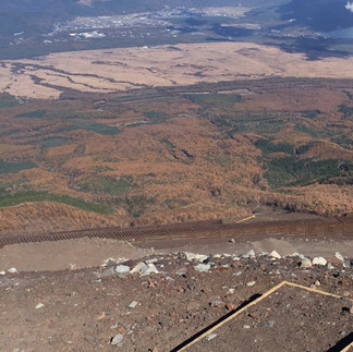
Between 5th and 6th station (the first aid center), the trail was mostly graded pathway and some stairs. There were sections of stone walkways, as well as "tunnels" to protect hikers from rocks that can come down.

A pano around 6th station

The above shot is looking up from the start of the trail to the top of Fuji. Below are some shots from the start of the trail to around the 6th station.


There was a little centipede along the way


Between 6th and 7th Station, At Hanagoya Hut- looking up and down
At Hinodeken Hut


At 7th Station- you can see the path starts to change and become more rocky and moraine-like. This is where I had to wait the one and only time going up.

In several of the photos looking up the mountain, you can also see the tea houses perched on the side of the mountain above.
Nanagome-Tomoekan


The next aid station and Kamaiwakan. On the right of the first photo you can see some wood poles. You could buy these poles pretty much anywhere along the way to use as a walking stick (pretty useless from what I saw), but also at each hut you could pay a small fee to have it "branded" with their emblem. What wasn't advertised is that the huts also had ink stamps and I brought small squares of paper - I collected these stamps which were cheaper and lighter.


Fujiichikan


At Toriiso I walked up stairs and through a red Torii gate. An Australian was nice enough to take a photo of me here. I'll be honest - at this point I was having a sense of humor failure. The moraine walking was getting difficult for me - it was hot (around 80) and my pack was too heavy due to all the water. Yes, I started to drink more to get rid of the weight, but the electolyte tablets I used put me off as they weren't tasting very good.
You can see how much water I was losing by if you look at the bottom right picture - this is my butt print when I sat down.
The final picture below shows a sort of optical illusion I enjoy when hiking up mountains. It doesn't come out in the photos, but when you look out the world has become slanted - anywhere you walk will not be flat.


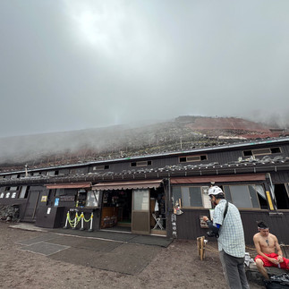
Finally the 8th Station


I reached the Taishikan Hut and it was 9:15am. It took me about 4 hours to get to 8th station and my room for the night (a double wide capsule!). I had a decision to make - summit or not? It would take about 3 hours from this point, according to the sign. The weather was nice now, but called for T-Storms. According to the staff (who strangely had never been to the top), the trail moving forward was less moraine walking. Now I had the option of leaving most everything from my pack in the room which wouldn't be the case if I did it tomorrow. Dinner wasn't until 6pm and what was I supposed to do with the rest of the day? Of course I decided to continue and asked them to send out a search party if I wasn't back by 7pm. I would be at the top in time to have lunch!
Toyokan Hut


Houraikan Hut - and around now I started hearing thunder in the distance...


Gansomuro Hut - more thunder. I was praying at the shrine that it would hold off:) No one seemed particularly worried


Tomoekan Hut


Goreikan Hut and 9th station is in sight (grey torii gate). Only 900 M left to the top!


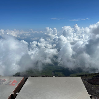
9th Station does not have a hut. The structure that was there has collapsed and no where to sit - disappointing after all the nice stops up to there....Also, not much view as the clouds were coming around. In the first picture below the summit looks tantalizingly close!


And I was finally able to see the storm making the thunder noises

The last 200 meters (from the 9th station to the top) was a bit agonizing. It looked so close, but the moraine walking in the heat was debilitating. And I wasn't really pleased to hear the thunder. A note about thunderstorms in the mountains - basically, you don't want to be on a mountain during a thunderstorm. There is no where to run and you are the tallest thing around.
I took it slowly and made it to the top at 12:20 - roughly 2.5 hours from my start at Taishikan and 30 minutes faster than the estimated time.


I was surprised and happy that the trail did not seem crowded. It was clear there were other hikers, but there were no back-ups and you'd see only about 5 or 10 others walking the same stretch.
I was planning a nice relaxing lunch and a walk around the crater,

but the thunder persisted and I was getting baked by a very strong sun (I found out later it was 78 degrees at the summit that day), so had a snack, got a stamp, and started down.


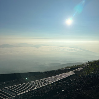
Going down was much easier - no moraine walking and the path was a sort of scree. I was glad to have 2 real walking poles as it was quite steep at times.


There was a small window in the clouds to see lower down the mountain (last photo above)
I got back to the hut in about 2 hours, so was back by about 3:30 and it did start to sprinkle for the last 25 minutes or so - thankfully I brought my rain coat.
To get back to the hut I needed to move over/transition from the "down trail" to the "up trail" to get back over to my hut. Unfortunately, it meant going down a small portion of the moraine walk on tired legs.
About 15 minutes after I was safely at the hut, a huge downpour started with a very strong thunder blast. The mountain guides raced outside to help hikers under the protection of the hut's overhang. Luckily a) I was not out trying to get back and b) no one was hurt
I decided that I would probably not go up again in the morning to see the sunrise from the top. I was happy not to have had to hike today's route in the dark and the sunrise was supposed to be very nice from the 8th station. As the proverb says, "He who climbs Mt. Fuji is a wise man; he who climbs twice is a fool.”
Dinner was "Fuji curry" and was very tasty, maybe because I hadn't eaten much all day. I did finish all my water. I did not eat the sausage (that's the carrot looking thing in the left side picture)


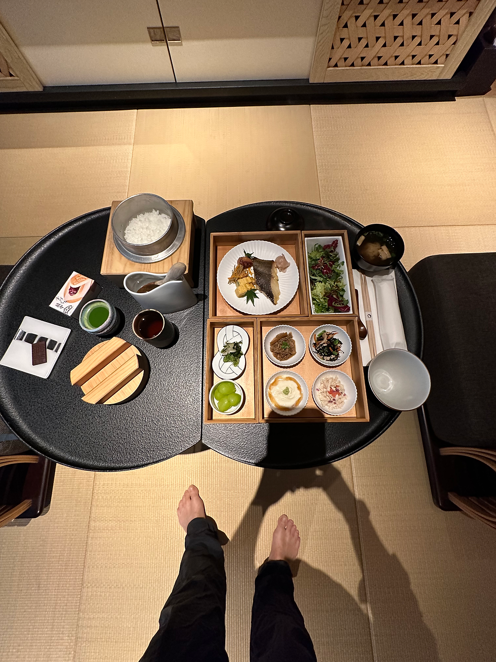
We also got our breakfast "bento", more on that in tomorrow's blog.
A word about the altitude. I hadn't planned to do the summit in one day which would have given me an extra day for acclimatization. That said, I was pleasantly surprised that the effect of altitude was minimal. I might not have even noticed if I hadn't experienced it before. On the way up I had very slight nausea, slight headache, loss of appetite and developed a rather productive cough upon descent. I did not take any diamox. This makes me feel very encouraged for my next high altitude hike in October (Druk Path) which will be a similar 1 day elevation gain.
In the fall of 1832, Tatsu Takayama became the first woman on record to reach the top. Lady Fanny Parkes, the wife of British ambassador Sir Harry Parkes, was the first non-Japanese woman to ascend Mount Fuji in 1867. It turns out that my ascent was 2 days shy of the 10 year anniversary of Fuji's becoming a UNESCO world heritage site.
The stamps I collected - from left to right
5th station, 7th station, 8th station, summit


Comments